Best Hiking Near Killington
· by the owners of Trail Creek 74
Here are our favorite trails, organized by difficulty:
Easy
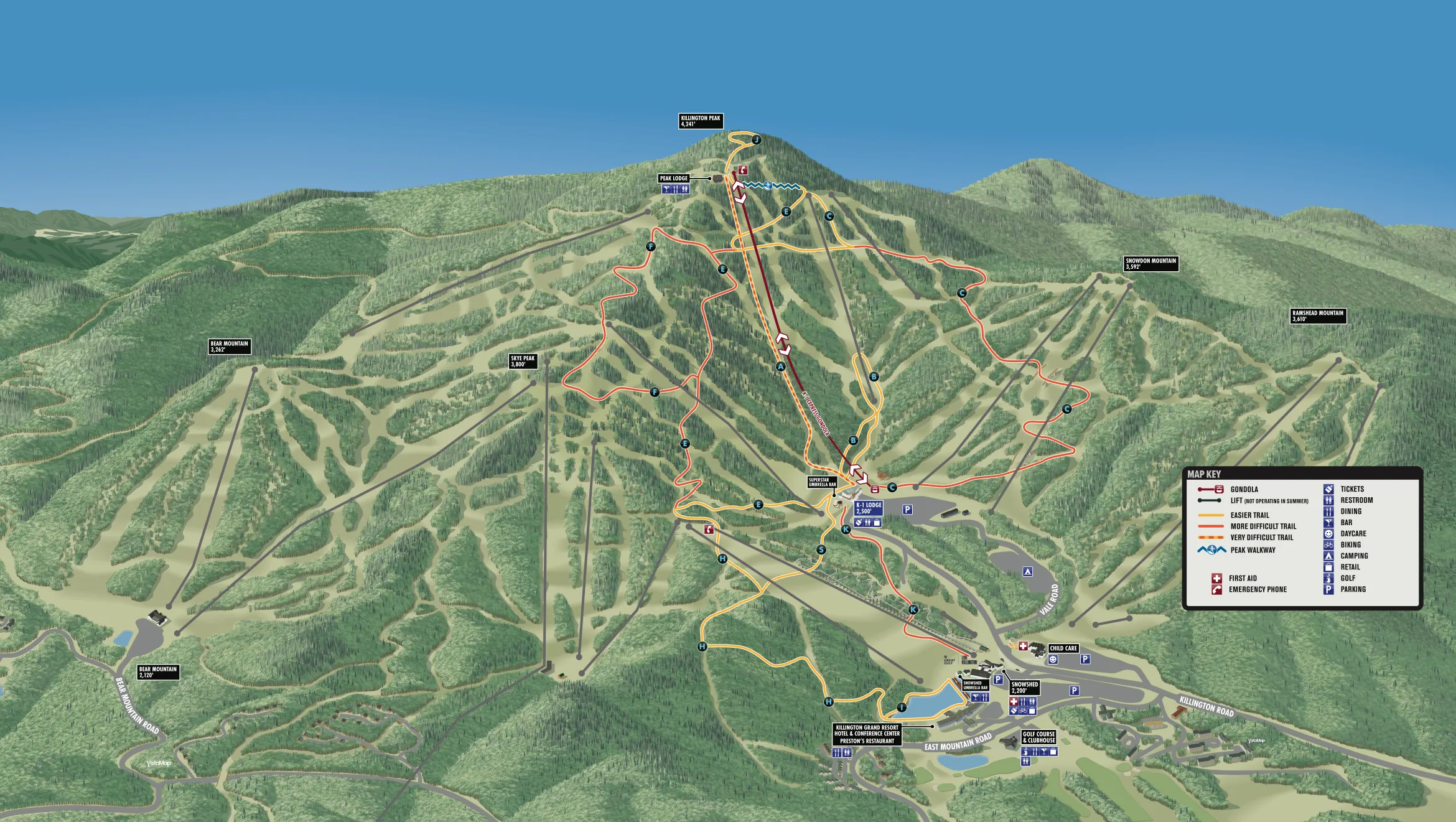
Loop ‘I’
- Distance: 1 mile loop
- Surface: Gravel, grass
- Some minor rough footing
- Time: 30 mins.
Accessed via the upper parking lot of Trail Creek, the ‘I’ Loop trail takes the walker around the pond, across the footbridge, and back along the gravel path to Trail Creek.
I Loop is perfect for a post-coffee morning stroll, dog walk, or afternoon trek to the Snowshed Umbrella bar.
Directions: From the upper Trail Creek parking lot, see the signage for I Loop and follow it clockwise or counter-clockwise.
Moderate
Trail Creek to Snowshed Peak
- Distance: 3.43 miles out and back
- Surface: Gravel, grass, some rough footing
- Time: 90 mins.
Looking for a longer walk through the hardwood forest and grassy slopes, ending at the top of the Snowshed Express chairlift for views to the North? This loop is for you.
Directions: Take Trail I across the dam to Trail H and follow the signage to the top of Snowshed slope.
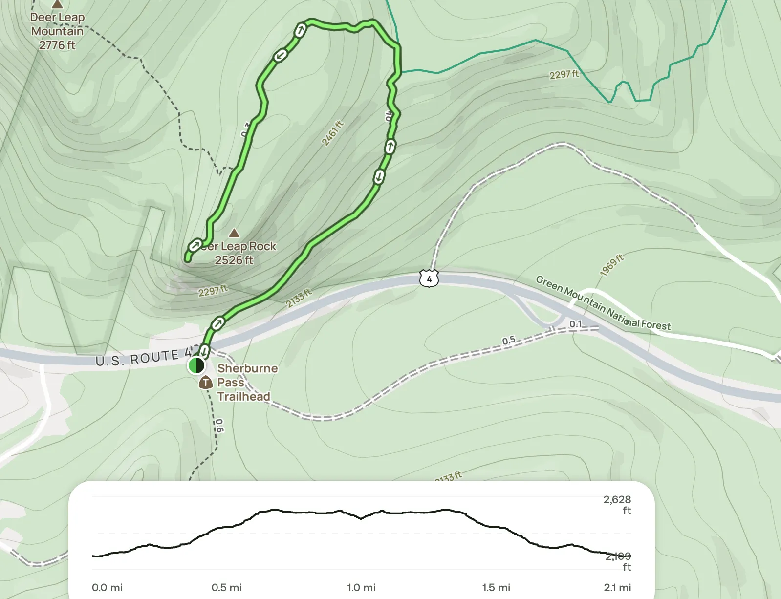
Deer Leap Overlook Trail
- Distance: 2.1 miles, out and back
- Elevation gain: 495 feet
- Time: 1-1.5 hr
Want a hike with a view? Deer Leap Rock is a local’s favorite.
Park in the lot by the Sherburne Pass Trailhead and cross Route 4 toward the Inn at Long Trail. The Sherburne Pass Trail begins by heading uphill; you will then follow the Appalachian/Long Trail for a short stretch to the Deer Leap Trail. Climb up to your choice of view. From here, there is a wonderful view looking back towards Pico and Killington. Additional parking is available in a smaller lot on the other side of Route 4.
Difficult
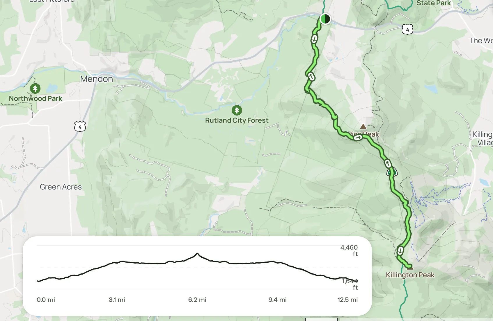
Killington Peak via Long Trail
- Distance: 12.5 miles, out and back
- Elevation gain: 3,152ft.
- Time: 7-8 hours
- Parking Lot GPS Coordinates: 43.66622, -72.84916
Looking for a challenge while bagging both Pico and Killington Peaks? Look no further!
Mount Killington is the second tallest mountain in the Green Mountains of Vermont at 4,235 feet.
Pico Peak (pronounced pike-o) is a 3,957-foot mountain located in Killington, Vermont, in Rutland County in the famous Green Mountains.
The parking lot is located where the Appalachian Trail (AT) crosses Route 4 in Mendon, VT.
Follow the AT/LT (Long Trail) south, crossing over the Mendon Brook. Then follow the trail up toward the top of Pico Peak. There is a 0.4-mile spur trail across from the Pico Camp Cabin to Pico Peak (3,957 ft.elevation), and then continue to Killington Peak (4,235 ft. elevation ).